There are a number of closures in Commonwealth managed waters to help manage the impacts of fishing to certain species or habitats. These closures can be used to restrict fishing to certain depths, gear types, locations and times of the year.
Closures may protect sensitive habitat areas like corals, sponges and seagrass beds in the Northern Prawn Fishery or protected species such as Australian Sea Lions in the Southern Eastern Shark and Scalefish Fishery.
These closures are implemented through legislative closure directions or fishing concession conditions.
Maps of closures
Find electronic map files (GPX, KMZ and SHP) for fisheries on the Maps of directions, closures and fishing areas page.
The maps below are indicative and should not be used for navigational or legal purposes.
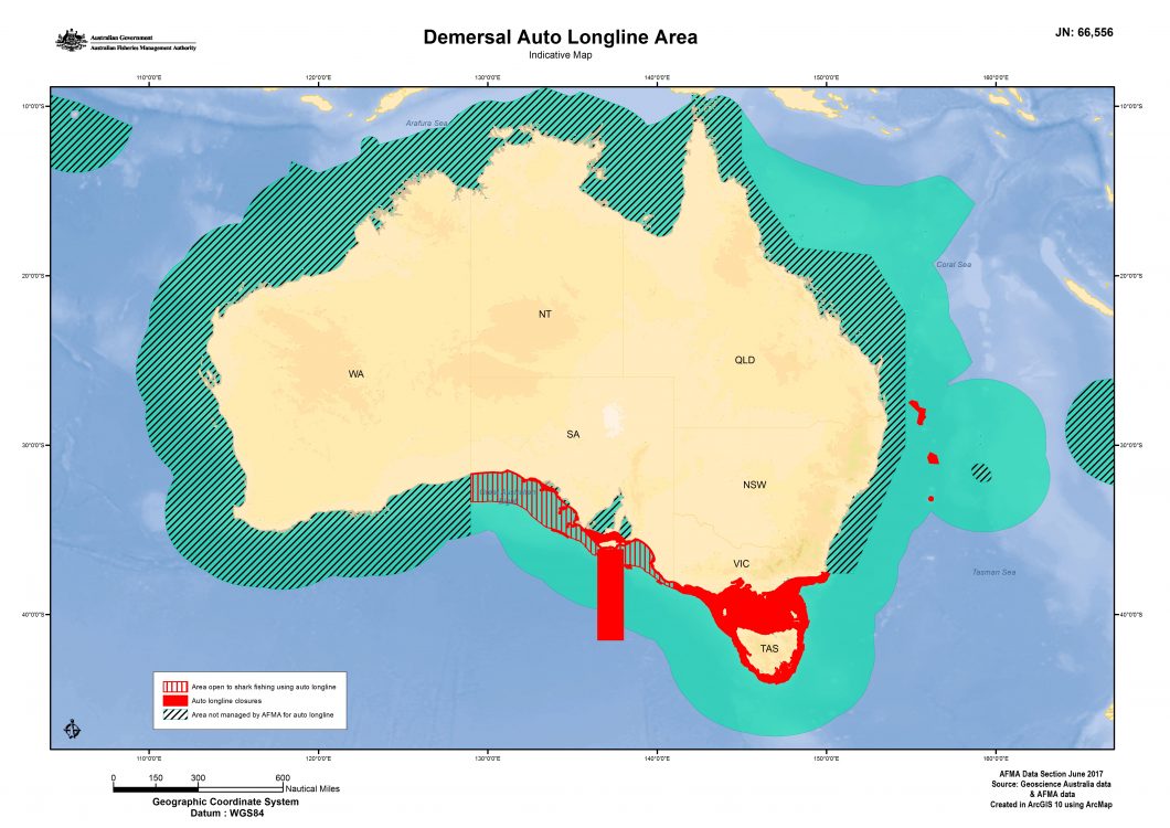
This map shows the Australian Fishing Zone, AFMA managed areas for demersal auto longline fishing and AFMA managed closed areas. Closure areas vary depending on season and species but collectively add up to about three hundred thousand km2 or approximately 10 per cent of the AFMA managed area.
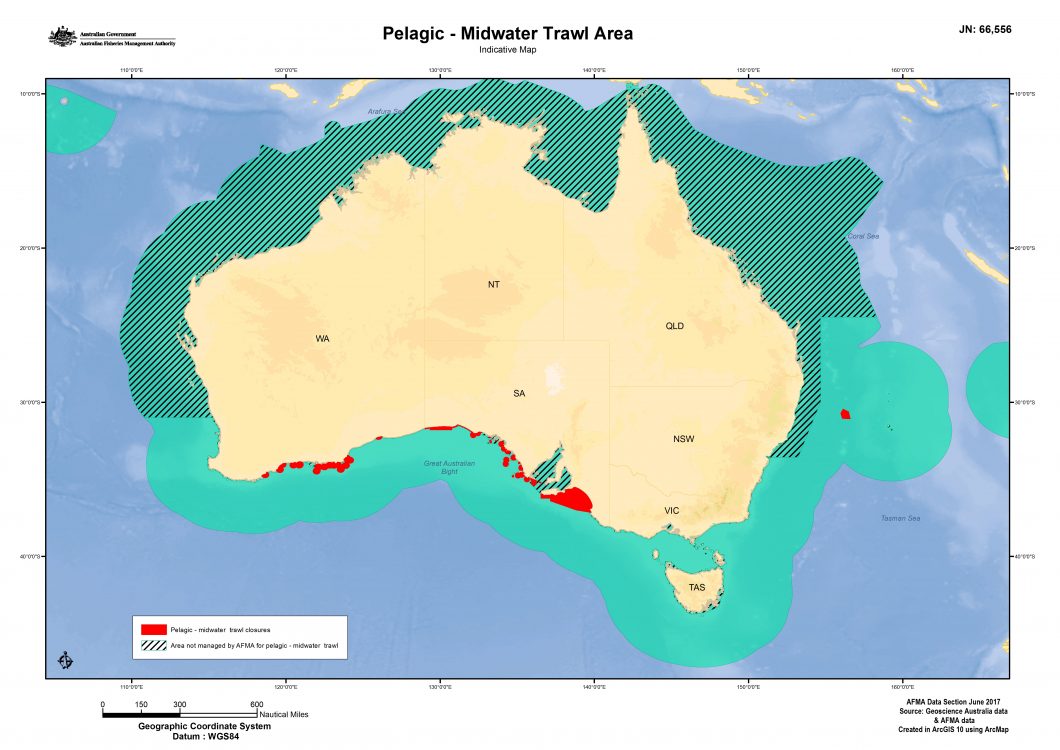
This map shows the Australian Fishing Zone, AFMA managed areas for pelagic/midwater trawl fishing and AFMA managed closed areas. Closure areas vary depending on season and species but collectively add up to about sixty-four thousand km2 or just over 1 per cent of the AFMA managed area. This map does not include closures for pair trawling.
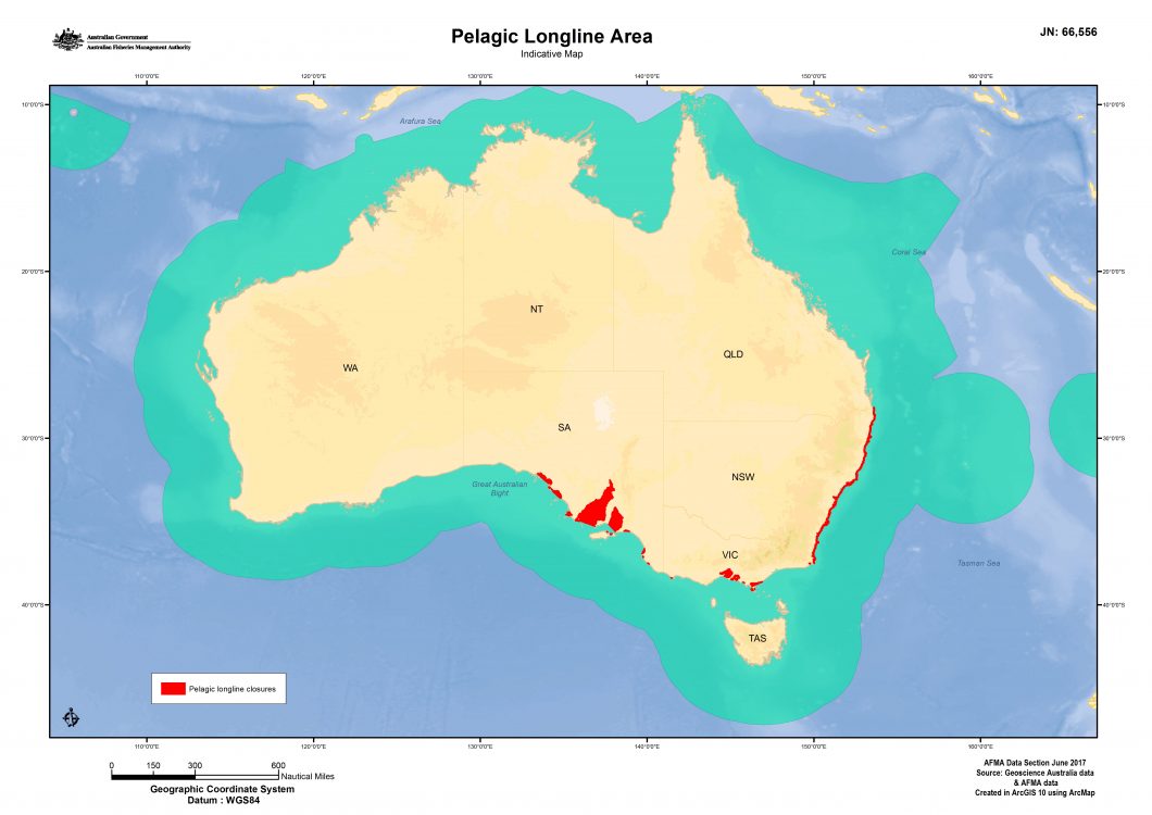
This map shows the Australian Fishing Zone, AFMA managed areas for pelagic longline fishing and AFMA managed closed areas. Closure areas can vary depending on season and species but collectively add up to about forty-five thousand km2 or less than 1 percent of the AFMA managed area.
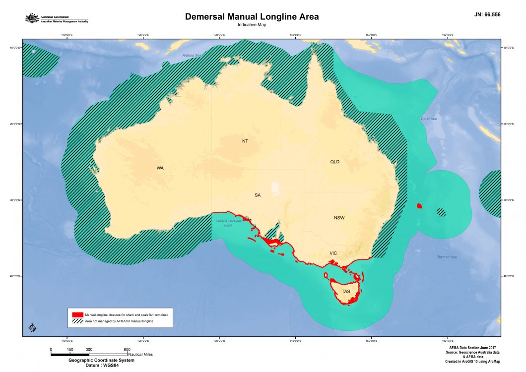
This map shows the Australian Fishing Zone, AFMA managed areas for demersal manual longline fishing and AFMA managed closed areas. Closure areas vary depending on season and species but collectively add up to about eighty-six thousand km2 or approximately 3 per cent of the AFMA managed area.
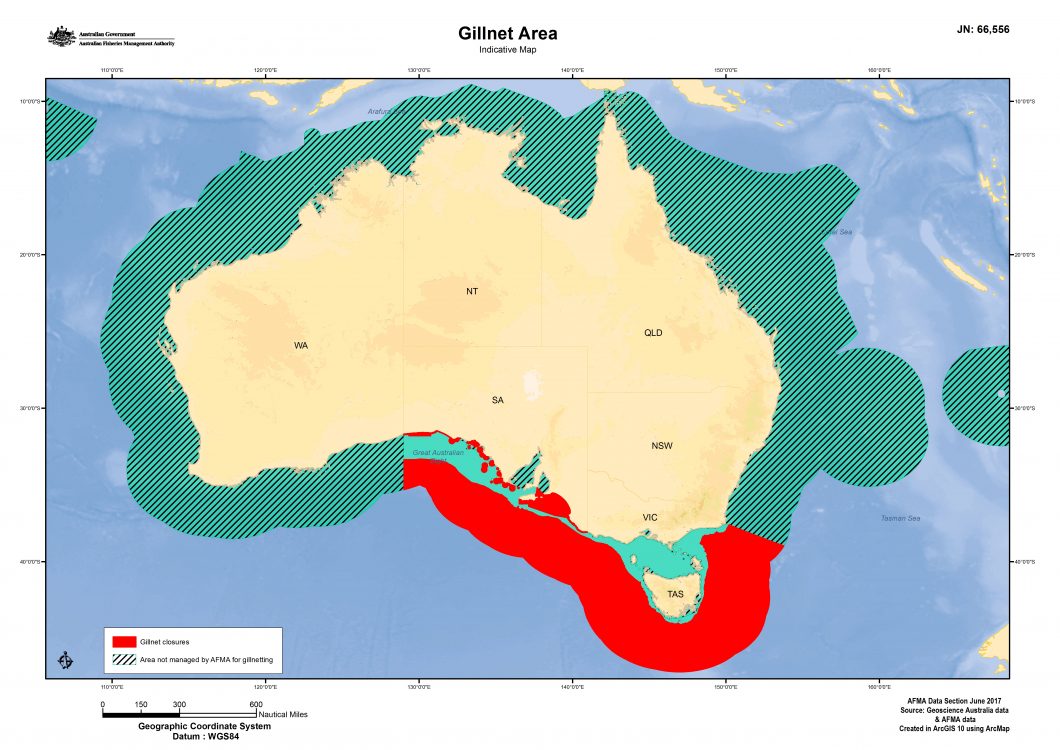
This map shows the Australian Fishing Zone, AFMA managed areas for gillnet fishing and AFMA managed closed areas. Closure areas vary depending on season and species but collectively add up to about 1.1 million km2 or approximately 81 per cent of the AFMA managed area.
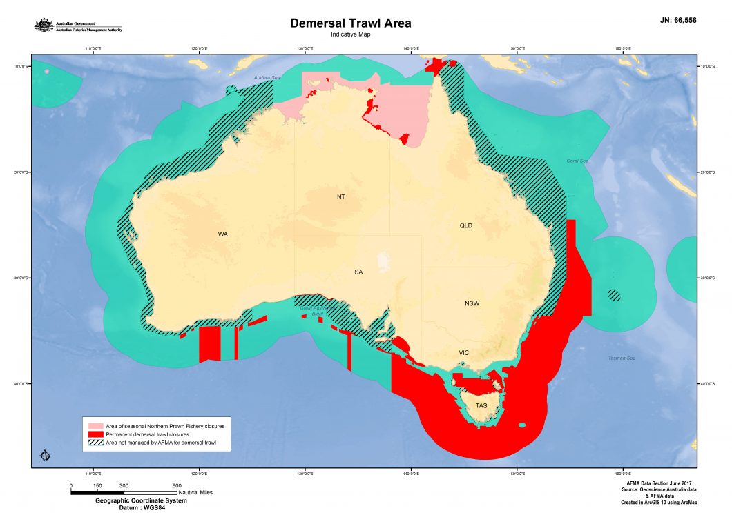
This map shows the Australian Fishing Zone, AFMA managed areas for demersal trawl fishing and AFMA managed closed areas. Closure areas vary depending on season and species but collectively add up to about 1.8 million km2 or approximately 23 per cent of the AFMA managed area.